


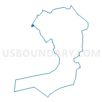
Voting District 3700020, Queens County, New York
About
Outline

Summary
| Unique Area Identifier | 634273 |
| Name | Voting District 3700020 |
| County | Queens County |
| State | New York |
| Area (square miles) | 0.21 |
| Land Area (square miles) | 0.17 |
| Water Area (square miles) | 0.04 |
| % of Land Area | 79.09 |
| % of Water Area | 20.91 |
| Latitude of the Internal Point | 40.74116290 |
| Longtitude of the Internal Point | -73.95706680 |
Maps

Graphs
Select a template below for downloading or customizing gragh for Voting District 3700020, Queens County, New York


Neighbors
Neighoring Voting District (by Name) Neighboring Voting District on the Map
- Voting District 3700019, Queens County, NY
- Voting District 3700021, Queens County, NY
- Voting District 5000095, Kings County, NY
- Voting District 5000096, Kings County, NY
- Voting District 7300119, New York County, NY
- Voting District 7400005-7400008, New York County, NY
Top 10 Neighboring County Subdivision (by Population) Neighboring County Subdivision on the Map
- Brooklyn borough, Kings County, NY (2,504,700)
- Queens borough, Queens County, NY (2,230,722)
- Manhattan borough, New York County, NY (1,585,873)
Top 10 Neighboring Place (by Population) Neighboring Place on the Map
Top 10 Neighboring Unified School District (by Population) Neighboring Unified School District on the Map
Top 10 Neighboring State Legislative District Lower Chamber (by Population) Neighboring State Legislative District Lower Chamber on the Map
- Assembly District 50, NY (133,740)
- Assembly District 74, NY (133,261)
- Assembly District 65, NY (132,385)
- Assembly District 37, NY (124,254)
Top 10 Neighboring State Legislative District Upper Chamber (by Population) Neighboring State Legislative District Upper Chamber on the Map
- State Senate District 17, NY (341,278)
- State Senate District 29, NY (333,345)
- State Senate District 28, NY (321,361)
- State Senate District 12, NY (302,224)
Top 10 Neighboring 111th Congressional District (by Population) Neighboring 111th Congressional District on the Map
Top 10 Neighboring Census Tract (by Population) Neighboring Census Tract on the Map
- Census Tract 1, Queens County, NY (4,949)
- Census Tract 7, Queens County, NY (4,790)
- Census Tract 62, New York County, NY (4,437)
- Census Tract 563, Kings County, NY (4,360)
- Census Tract 86.01, New York County, NY (2,618)
- Census Tract 579, Kings County, NY (1,117)
- Census Tract 86.02, New York County, NY (0)